Browse Items (20 total)
- Collection: Drawings
Sort by:
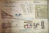
Cork Harbour Fort Camden
Record Plan of Brennan Torpedo Installation
Reference Date of War Office Authority: 20th July 1889 Date of Commencement of work: 4th November 1889 Date of Completion of work: 25 Feburary 1893
Tags: #MakeAConnection, #ShareAStory, 1889, 1893, 1894, 1907, Brennan, Brennan Torpedo Installation, Brennan's Torpedo, C.I.M. R.E., Cliffe Fort, cork harbour, Fort Albert, Fort Camden, Garrison Point Fort, Installation, Jno Reilley, Louis Brennan, louis philip brennan, lye mun, map, Military, Our heritage, pier cellars, Plan, RE Museum, Record, ricasoli, Royal Engineers Museum, technical drawing, tigne, Torpedo, W. O., War Office, Where the past meets the Future
Map - Partial
Brennan Torpedo Installation depicting layout including surrounding buildings and final tramway arrangement.
This final track arrangement can be confirmed by studying current pictures of the Architectural features of the Brennan Torpedo…
This final track arrangement can be confirmed by studying current pictures of the Architectural features of the Brennan Torpedo…
Hark! Hark! The Dogs do Bark
with Note by Walter Emanuel
Satirical Map featuring the Dogs of War loose in Europe. Written explanation adds to the striking visual narrative of early WW1 events.
Angling in Troubled Waters
A Serio-Comic Map of Europe featuring tales and tackle of the day.
Upended countries struggle under the weight of war and trust.
Upended countries struggle under the weight of war and trust.
Map of England
A Modern Saint George and the Dragon
Satirical Map of England and Wales depicting the Irish Home Rule Woes - 1886. St. George is Lord Salisbury who inflicts pain on the Dragon: Prime Minister William Gladstone.
Look closely to see Charles…
Satirical Map of England and Wales depicting the Irish Home Rule Woes - 1886. St. George is Lord Salisbury who inflicts pain on the Dragon: Prime Minister William Gladstone.
Look closely to see Charles…
Seat of War
The Crimean War which waged between 1853-1856 is told in animalistic caricature with glimpses of human interaction throughout. This comic cartograph brings a sense of reality to unfolding conflicts of war.
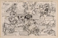
L'Europe en ce Moment - Fantasie Politico-Geographique
Europe at This Moment - A Political-Geographic Fantasy
A satirical reflection of the Franco-Prussian war in cartographic format. The defeat of France, Prussian Southern unity and the rise of Germany, dominate the caricatures in this visually…
A satirical reflection of the Franco-Prussian war in cartographic format. The defeat of France, Prussian Southern unity and the rise of Germany, dominate the caricatures in this visually…
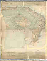
Fort Camden, County of Cork
Technical Drawing of Fort Camden Surveyed in 1880 under the direction of Captain G. I. Gould R. E. & revised up to 1 Mar 1882 R. M. Sandford Lieut - Colonel C. R. E.
Fort Camden Fire Tanks for Married Quarters
Map showing position of Fire Tanks for Married Quarters
1884 Map of Fort Camden
Fort Camden, Cork Harbour. Map of Gun emplacements 2 X 64 Pounders + 7 X 10" Guns
Signed R H Sandford
Signed R H Sandford
Tags: 1884, cork harbour, Fort Camden, Gun Emplacements, map, technical drawing


